


Voting Districts not defined, Mackinac County, Michigan
About
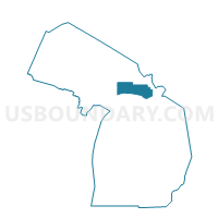
Outline

Summary
| Unique Area Identifier | 597729 |
| Name | Voting Districts not defined |
| County | Mackinac County |
| State | Michigan |
| Area (square miles) | 1,022.06 |
| Land Area (square miles) | 0.00 |
| Water Area (square miles) | 1,022.06 |
| % of Land Area | 0.00 |
| % of Water Area | 100.00 |
| Latitude of the Internal Point | 45.91570710 |
| Longtitude of the Internal Point | -84.92495120 |
Maps


Graphs
Select a template below for downloading or customizing gragh for Voting Districts not defined, Mackinac County, Michigan


Neighbors
Neighoring Voting District (by Name) Neighboring Voting District on the Map
- Voting District 0332177000001, Chippewa County, MI
- Voting District 0336676000001, Chippewa County, MI
- Voting District 097000001, Mackinac County, MI
- Voting District 0970950000001, Mackinac County, MI
- Voting District 0971606000001, Mackinac County, MI
- Voting District 0973162000001, Mackinac County, MI
- Voting District 0973162000002, Mackinac County, MI
- Voting District 0973766000001, Mackinac County, MI
- Voting District 0973976000001, Mackinac County, MI
- Voting District 0975028000001, Mackinac County, MI
- Voting District 0975188000001, Mackinac County, MI
- Voting District 0975548000001, Mackinac County, MI
- Voting District 0975764000001, Mackinac County, MI
- Voting District 0977084000001, Mackinac County, MI
- Voting District 0977086000001, Mackinac County, MI
- Voting District 1535606000001, Schoolcraft County, MI
- Voting Districts not defined, Schoolcraft County, MI
- Voting Districts not defined, Presque Isle County, MI
- Voting Districts not defined, Charlevoix County, MI
- Voting Districts not defined, Cheboygan County, MI
- Voting Districts not defined, Chippewa County, MI
- Voting Districts not defined, Emmet County, MI
Top 10 Neighboring County Subdivision (by Population) Neighboring County Subdivision on the Map
- St. Ignace city, Mackinac County, MI (2,452)
- Clark township, Mackinac County, MI (2,056)
- Garfield township, Mackinac County, MI (1,146)
- Moran township, Mackinac County, MI (994)
- St. Ignace township, Mackinac County, MI (939)
- Detour township, Chippewa County, MI (807)
- Wawatam township, Emmet County, MI (661)
- Raber township, Chippewa County, MI (647)
- Marquette township, Mackinac County, MI (603)
- Mackinaw township, Cheboygan County, MI (539)
Top 10 Neighboring Place (by Population) Neighboring Place on the Map
Top 10 Neighboring Elementary School District (by Population) Neighboring Elementary School District on the Map
Top 10 Neighboring Unified School District (by Population) Neighboring Unified School District on the Map
- Cheboygan Area Schools, MI (14,220)
- Manistique Area Schools, MI (7,611)
- St. Ignace Area Schools, MI (3,903)
- Les Cheneaux Community Schools, MI (2,279)
- DeTour Area Schools, MI (2,190)
- Engadine Consolidated Schools, MI (1,955)
- Mackinaw City Public Schools, MI (1,278)
- Beaver Island Community School, MI (657)
- Mackinac Island Public Schools, MI (492)
- School District Not Defined (Water), MI (243)
Top 10 Neighboring State Legislative District Lower Chamber (by Population) Neighboring State Legislative District Lower Chamber on the Map
- State House District 105, MI (95,524)
- State House District 109, MI (90,978)
- State House District 107, MI (86,648)
- State House District 106, MI (86,395)
Top 10 Neighboring State Legislative District Upper Chamber (by Population) Neighboring State Legislative District Upper Chamber on the Map
Top 10 Neighboring 111th Congressional District (by Population) Neighboring 111th Congressional District on the Map
Top 10 Neighboring Census Tract (by Population) Neighboring Census Tract on the Map
- Census Tract 9601, Cheboygan County, MI (2,979)
- Census Tract 9710, Chippewa County, MI (2,922)
- Census Tract 9504, Mackinac County, MI (2,662)
- Census Tract 1, Schoolcraft County, MI (2,611)
- Census Tract 9505, Mackinac County, MI (2,423)
- Census Tract 9502, Mackinac County, MI (2,370)
- Census Tract 9701, Emmet County, MI (2,223)
- Census Tract 9503, Mackinac County, MI (2,021)
- Census Tract 9711, Chippewa County, MI (1,650)
- Census Tract 9501, Mackinac County, MI (1,637)
Top 10 Neighboring 5-Digit ZIP Code Tabulation Area (by Population) Neighboring 5-Digit ZIP Code Tabulation Area on the Map
- 49781, MI (4,020)
- 49719, MI (1,362)
- 49745, MI (1,089)
- 49701, MI (1,036)
- 49840, MI (771)
- 49725, MI (766)
- 49760, MI (713)
- 49762, MI (639)
- 49736, MI (578)
- 49838, MI (504)